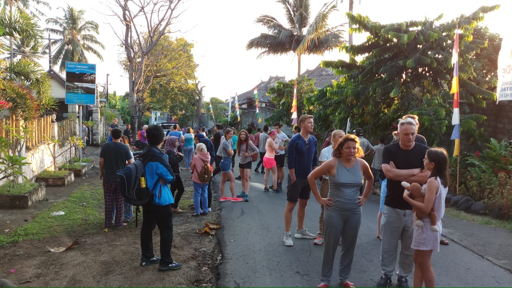
The main income for many in Lombok is tourism. Today’s 6.4 earthquakes that rocked the island of Lombok claimed at least ten deaths and 40 injured. 66 aftershocks, some up to 5.7 had been recorded and the potential of a Tsunami is still ongoing until 9.20 GMT July 29. If you are in the area, you should monitor local media, exercise caution and follow the advice of the local authorities. Lombok is a short ferry trip from Bali, the most known island for international tourists. Bali was not affected by the earthquake, and as of this time, no reports are known of any tourists on Lombok injured. However, the earthquake was felt in Bali. Samantha Cope said from Bali:”So sad for people in Lombok. We were woken by our hotel room shaking in Bali.”
Lombok is a different world compared to Bali. Bali a dominant Hindu region in Indonesia is a very busy island with nightclubs, massive traffic, and large hotel buildings. The Muslim island of Lombok is very different. Quiet, untouched, small buildings and beautiful resorts tacked in nature. It’s a favorite spot for a quiet holiday. Lombok is an island in the West NUsa Tenggara Province (Nusa Tenggara Barat) and its located between Bali and Sumbawa island in the eastern part of Indonesia. Mataram is the administrative capital and its the larger city on the island and has about 2.500.000 in habitants. The Population in Lombok is about 3,5 million, and majority 91% are Moslem. Hindus make up about 6% while Christians and Buddhist about 3%. Lombok lies 8 degrees south of the equator and stretches some 80km east to west and about the same distance north to south. It is dominated by the second highest mountain in Indonesia, GUNUNG RINJANI, which soars to 3726m. It has a large caldera with a Crater Lake, Segara Anak, 600m below the rim, and a new volcanic cone which has formed in the center. Rinjani last erupted in 1994, and evidence of this can be seen in the fresh lava and yellow sulfur around the inner cone. Central Lombok, to the south of Rinjani, is similar to Bali with rich alluvial plains and fields irrigated by water flowing from the mountains. In the far south and east it is drier, with scrubby, barren hills. This area gets little rain and often has droughts which can last for months. In recent years, several dams have been built, so the abundant rain-fall of the wet season can be retained for irrigation throughout the year. The Lombok Strait marks the passage of the biogeographically division between the fauna of the Indomalayan ecozone and the distinctly different fauna of Australasia that is known as the Wallace Line, for Alfred Russel Wallace, who first remarked upon the distinction between these two major biomes.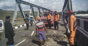
The island’s topography is dominated by the centrally-located strato volcano Mount Rinjani, which rises to 3,726 m (12,224 ft), making it the third-highest in Indonesia. The most recent eruption of Rinjani was in June-July, 1994. The volcano, and its sacred crater lake, ‘Segara Anak’ (child of the sea), are protected by a National Park established in 1997. The southern part of the island is a fertile plain where corn, rice, coffee, tobacco, and cotton are grown.